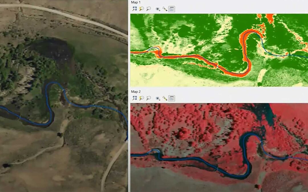
Beaver Dam Census Screenshot
Defenders of Wildlife has contracted with Utah State University to perform a virtual beaver dam census for the entire state of New Mexico. A virtual beaver dam census, which is a single snapshot in time based on the date of the aerial imagery used, will be conducted for the entire state of New Mexico. The most current imagery available will be used. The census will consist of a point location for every beaver dam visible on the imagery. Censusing will be done along the entire perennial 1:24,000 National Hydrography Dataset (NHD) stream network at the Hydrologic Unit Code (HUC 8) level. In the case with partial HUC 8 coverage, the census will end at the New Mexico border instead of including the entire HUC 8 area. There are a total of 85 HUC 8s in New Mexico (52 that are partially in NM, 12 of these only have a sliver in NM). Dam locations as a point file will be served out using standardized symbology on a web GIS map (QRAVE) and through ARCRAVE for ESRI ArcMap and QRAVE for QGIS as well as a digital .pdf map atlas.
The resulting New Mexico statewide virtual beaver dam census will be used at a later date to validate the New Mexico statewide Beaver Restoration Assessment Tool (BRAT) model run. The validation step will consist of comparing actual beaver dam locations collected from the virtual census to the modeled capacity estimates from BRAT model using a python script called the BRAT Validation Tool. This tool directly compares actual dam densities to predicted dam densities at capacity for each stream reach.
Tasks
- Virtual beaver dam census: Conduct virtual beaver dam census.
- Map outputs: Generation of virtual beaver dam location map atlas.
- Riverscapes compliant: Making virtual beaver dam census data riverscapes compliant so it can be viewed through ArcRAVE, QRAVE, and WebRAVE.
- Data management: Setting up, managing, and serving out beaver dam location data on the riverscapes warehouse.
Deliverables
- New Mexico-wide virtual inventory of existing beaver dams as shapefiles and KMZ files.
- Map atlas showing base imagery and beaver dam locations.
- Project data curated and served out on riverscapes warehouse.
The New Mexico Beaver Dam Census report is complete. See the end of the report on how to obtain the data as shapefiles or .kmz files.